| Site description |
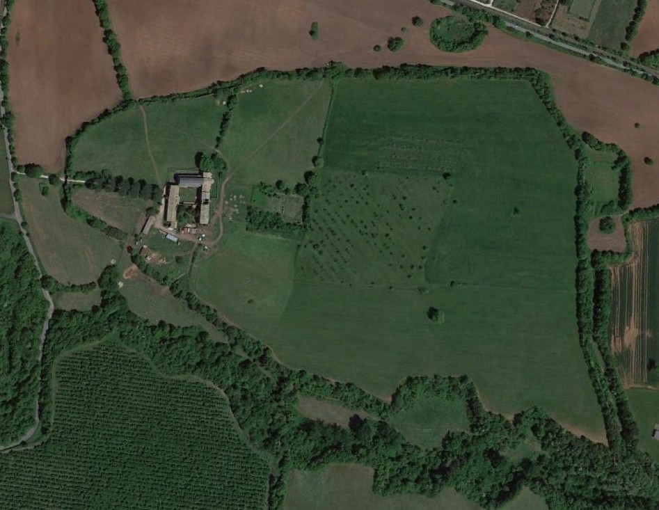
Falerii Novi is a roman town funded ex-novo in 241 BC, after the conquest of the Faliscan area (Ager Faliscus) and the destruction of the ancient city of Falerii (modern Civita Castellana), located ca. 5 km East on the opposite bank of the Rio Purgatorio stream. The new town was built on an empty plane characterized by a gentle slope with north-south direction, overlooking the forra (gully) created by Rio Purgatorio.
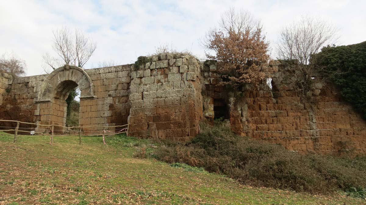
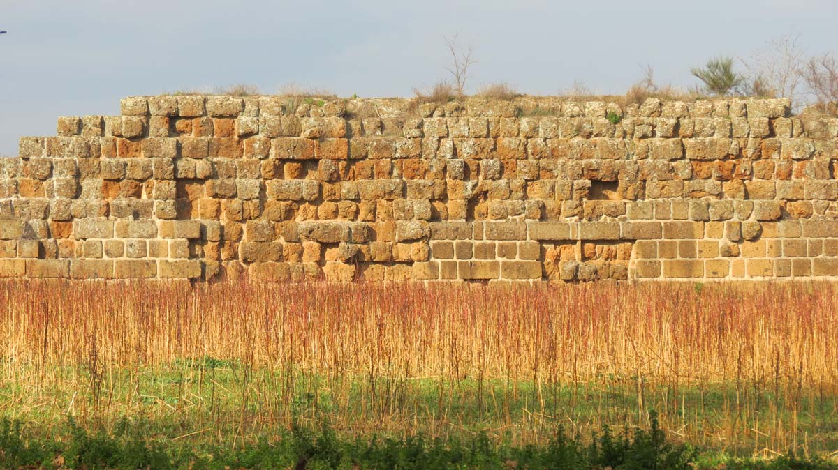
The most evident trace of the ancient flourishing of the site is the roman city wall circuit, built in large squared tufa blocks and preserved in its entire perimeter even up to 6 m height. In the inner area, the buildings and the streets of the roman town lie almost completely buried, made exception for an area excavated in second half of the last century. Outside the walls, the remains of the aqueduct reaching the city (NW) and the amphitheatre (NE).
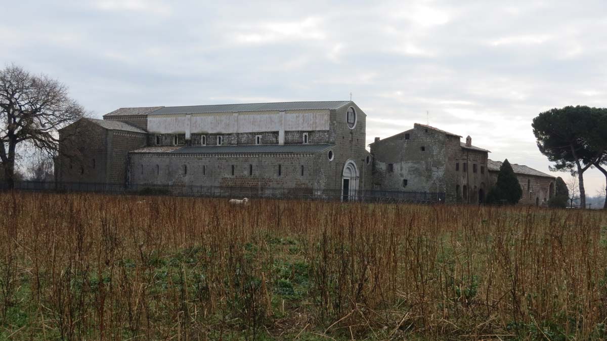
The site has been occupied up to the Medieval Era, and the Romanic church of Santa Maria in Falleri and part of the adjoining convent are still standing inside the West gate.
Excavations were carried on during the nineteenth century and the second half of the twentieth, but most of the areas were recover in soil, including the roman theatre. The urban area has been entirely surveyed with magnetometry, and lidar and field walking surveys have been also carried on in the surrounding area. |
| Threats |
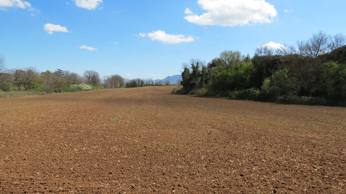
The site is a protected area because of the identified presence of archaeological heritage. Nevertheless, it mostly pertains to private property, exception made for the wall circuit and the church. The area is used for low tillage agriculture and pasture, which, together with the natural slope of the plain, facilitate soil erosion phenomena.
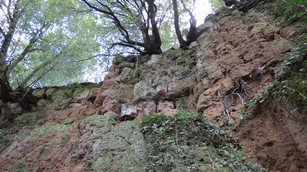
The topography of the south border of the site is characterized by a steep slope, susceptible to land movements. The roman city wall circuit is under the attack of uncontrolled vegetation growth that is already colonizing both the structures and the adjacent areas. |