
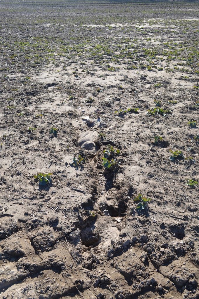
On March 11-13, 2022, the AMU RESEARCH team returned to Cisowo and Dzierżęcin to continue their survey research from last year. While in 2021 the survey had been conducted in extreme weather conditions, this time the weather was fine. The AMU team (Włodzimierz Rączkowski, Lidia Żuk, Filip Wałdoch) brought us – the lucky first-year students: Aleksandra Froehlich, Jan Czeski, Paweł Dmitrijew – with them to demonstrate to us what “surface research” actually is, and what tools we can use in our field-work. They were a far cry from conventional digging tools, and the most powerful of them was the knowledge and understanding of the role nature and erosion play in forming archaeological sites (Fig. 1).
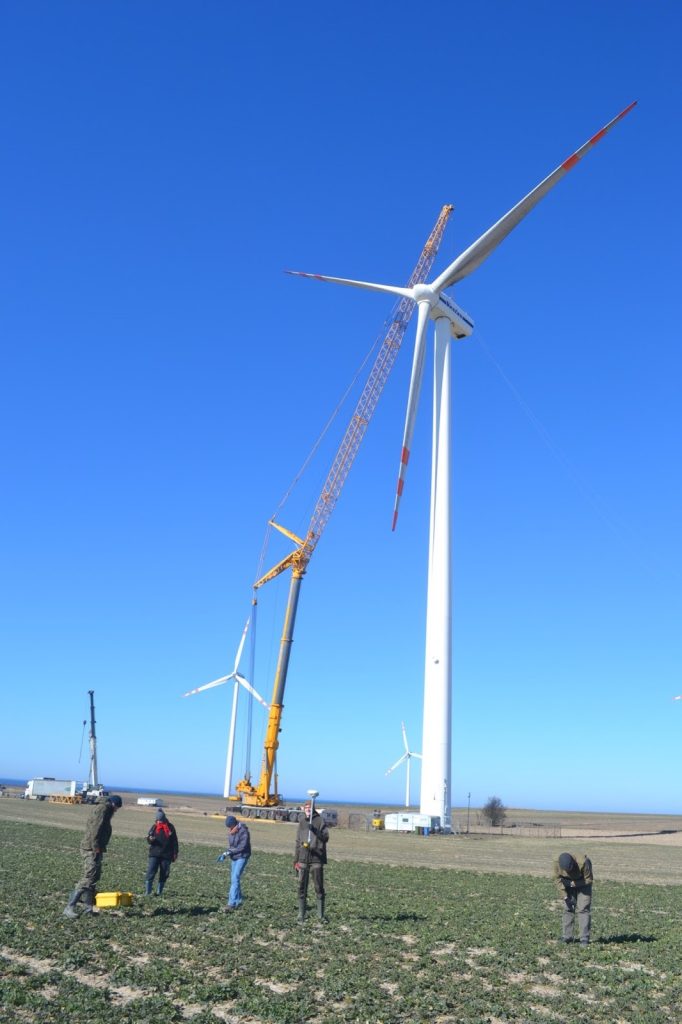
The survey was carried out without any major difficulties, with the exception of a wind turbine engine replacement on site, which turned out to be an absorbing spectacle indeed (Fig. 2). At one point, due to safety reasons, we were even asked to move further away from the wind turbine. Needless to say, we were quivering from excitement. This perilous situation did not last long and soon we were able to return to work. The wind turbine engineers’ bravery did earn our respect, as evidenced in the photo (Fig. 2). We all wished we could climb up the turbine and conduct our research (and admire the landscape) from such an impressive height, certainly avoiding being blown off by the wind. Overall, we preferred not to contemplate such a possibility.
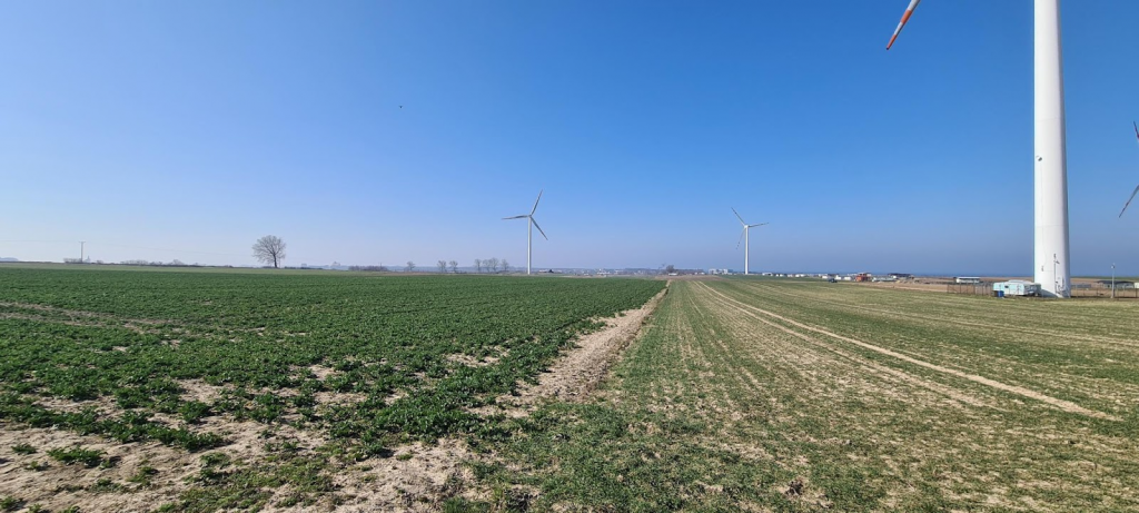
Our survey consisted of two parts and covered the same Cisowo and Dzierżęcin fields as last year. The first part corresponded to what had been done previously. Using the RTK GPS we recorded and measured every visible artefact on the ground and marked it with a different color than last year. Interestingly, we found no artefacts with the earlier red markings. This was actually really disappointing… Was it an effect of ploughing or poor paint quality? Since a big part of the area was covered with rapeseed plants (Fig. 3), which somewhat hampered our survey, all of us novices could at least comfort ourselves by blaming the cultivars for our failure.
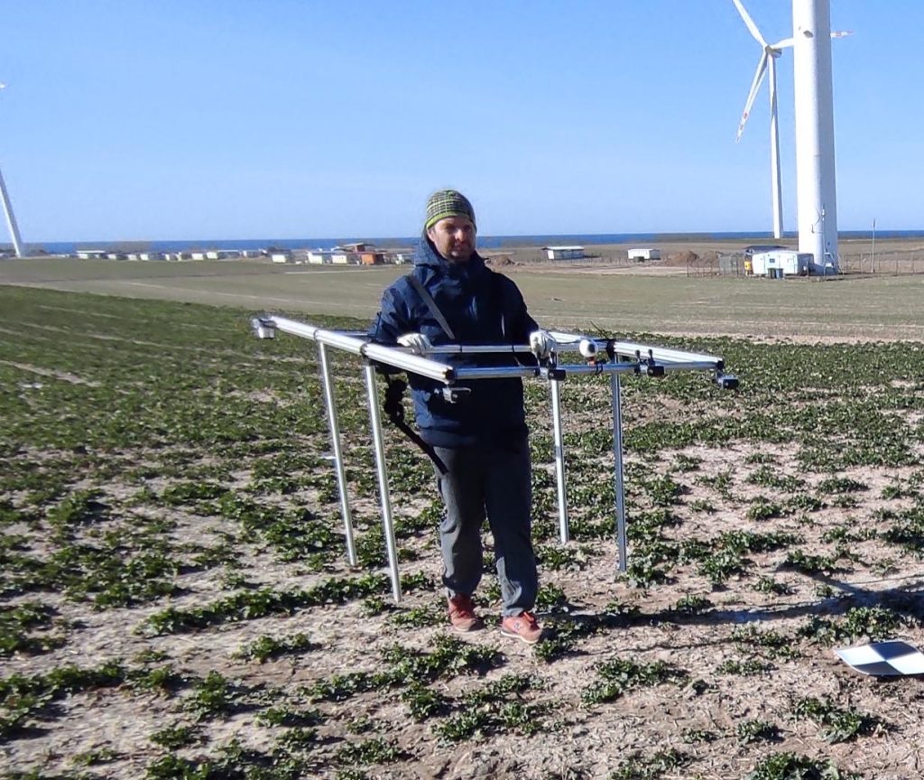
The second part of our survey was quite different from any archaeological enterprise we had heard of. Two smaller parts of surveyed areas were marked out: one in Cisowo and one in Dzierżęcin. The areas with the highest density of artefacts were chosen according to last year’s survey. Before the commencement of our survey Sławomir Królewicz and Adam Młynarczyk ‘aerially’ photographed the artefacts from a height of 1.5 m (!) (Fig. 4) to obtain an orthophoto map with a resolution of 1 millimeter. Unfortunately, due to a high wind, they could not take full advantage of their drone equipped with different cameras. Next, we examined these areas very carefully, being cautious not to move any artefact from its original position on the ground. When we found such an object we recorded its position using the GPS. The plan was to teach the computer program to find those artefacts, relying only on the previously taken photographs of the area. Although hesitant at first, we understood that, if effective, the use of such methodology would spare our legs some strain. However, until we see the final research results, walking – a traditional part of archaeological research – will continue to be more convincing to us.
Our plan is to return to Cisowo and Dzierżęcin for the second time, before completing the comprehensive analysis of survey results. We still hope that they will allow us to fully address the question of how erosion and cultivation influence the dispersion of artefacts.
Text by Aleksandra Froehlich and Jan Czeski